Dogsthorpe.com  The Genealogist - UK census, BMDs and more online
Login   Search
Skip Navigation Links
Home
Guest Book
Modern Map
Overlaid Map
1950s Map
1901 Map
1830 Map
Timeline
Early Dogsthorpe
Medieval Dogsthorpe
People
The Bluebell
Dogsthorpe Grange
The Manor
The Laurels
Lawn House
Sly's Farm
Fulbridge
Garton End
Blacksmith
Brickworks
1911 Census
Fire Station
Methodist Chapels
Schools in Dogsthorpe
Child Health Clinic & St Georges School
Trams in Dogsthorpe
Links
1821 Summary Justice
1854 Post Office Directory
1869 Post Office Directory
1888 Letter to Board of Guardians
1889 Election
1903 Kelly's Directory
Scroll up
Scroll down
William Fitzwilliam
William Sly
John Burbidge
Craig Family
Robert Hobbs
Sarah Ann and Leonard Letch
William Kitchen Parker
Plant Families
John Ross b1876
John Sturton
Vergette Family
Crunkhorn Family
John Meeks
Dr Clare Gerada
Scroll up
Scroll down
Medieval Garton End
The Comet
William Bone
Scroll up
Scroll down
Chapel Centenary Article 1
Chapel Centenary Article 2
Scroll up
Scroll down
National Schools
Dogsthorpe Schools in 1950s
Dogsthorpe Schools in 1960s
Scroll up
Scroll down

Links

  • myriad
  • The Handbag Shop
  • the-shine-shop.com
Skip Navigation Links>1950s Map

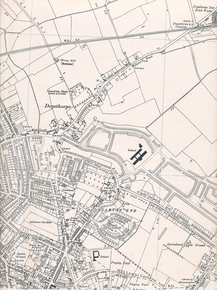
The map below dates from the 1950's, it is a copy of a map my daughter brought home after a school project over 10 years ago.

What I find particularly interesting are the parts of modern Dogsthorpe which are in the process of being developed. My house is one of the few built in Lawn Avenue. The new school is there, but Central Avenue shops and churches aren't, and that the new estate turns into fields beyond Chestnut Avenue. Not that any of the estate roads have names at this time.

The showground is south of Newark Ave, the building was a large grandstand which I used to play in, it was derelict in the 60's and I could go through the gate at the bottom of our garden in Garton End Rd, cut through what was then Garton End school and into the showground beyond.