Thanks to Glyn Bartlett for posting the following in the Guest Book. I had noticed Honey Hill on maps, but not looked into it any further.
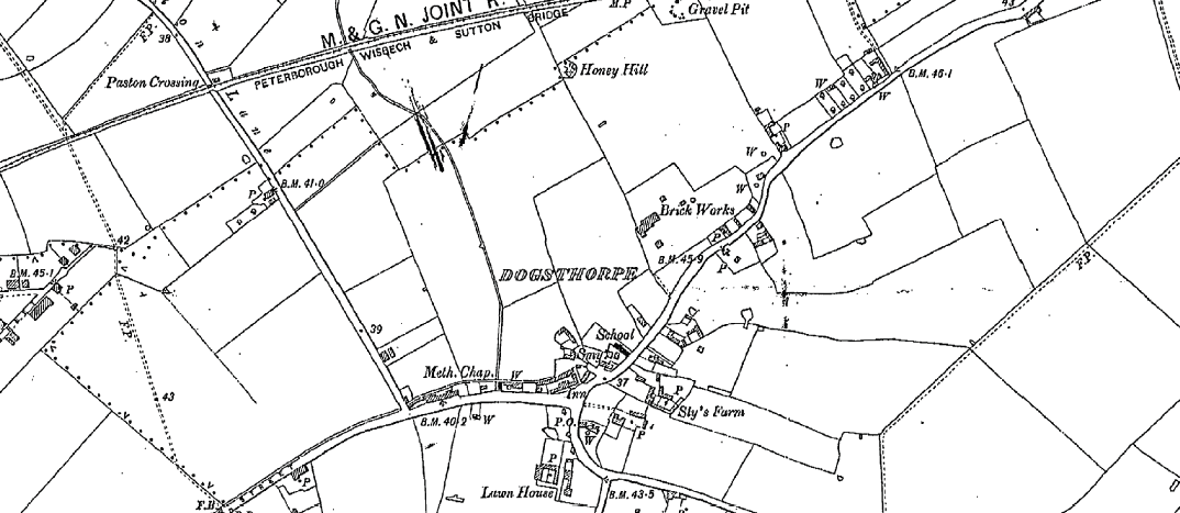
At one time Dogsthorpe had it's own windmill.Known locally as Honey Hill (AKA Bluebell Hill & The Nab) the site survived as a mound & pond 'till 1960 when it was cleared for housing development.(I spent many hours there in 1952 mostly when truanting from Welland Road School!) Historians were divided between moated wooden castle and a post mill site. The excavation prior to destruction revealed a few very old coins, some fragments of pottery and broken pieces of millstone. Probably constructed in the 13th. century. Located at the Crocus Grove end of the land now enclosed on two sides by Crocus Grove and Heather Avenue.(See Guestbook entry 01/01/12: Graeme Abbott for a mention of the place.)
Numerous internet refs. For example www.gatehouse-gazetteer.info -- "the listings" -- "Soke of Peterborough" -- "Dogsthorpe Honey Hill".
From http://www.gatehouse-gazetteer.info/English%20sites/2986.html:
Big millstead has been taken for a motte. Is now built over. Excavated in 1960. (King)
Excavation in 1960 to determine the age and purpose of the mound known as Honey Hill (locally known as Bluebell Hill and occasionally as the Nab) prior to its destruction by new housing proved that it was thrown up in the late C13 for a small post mill, and was abandoned in the C14. C13 - C14 pottery found , as well as later pottery. Weathered blue coated Nene Valley ware found. Clay pipes, approximately 100 Med nails, a farthing of Edward I found (c 1302 - 1307), also an Elizabethan sixpence of 1568. Fragments of millstone found. The Mound was destroyed during the construction of a new housing estate. Its site remains as a vague swelling of ground between houses and foot path. (City of Peterborough HER)
Not in the earthworks chapter of the VCH. Who had taken this for a motte?
The site can be seen at the top of this 1901 map.
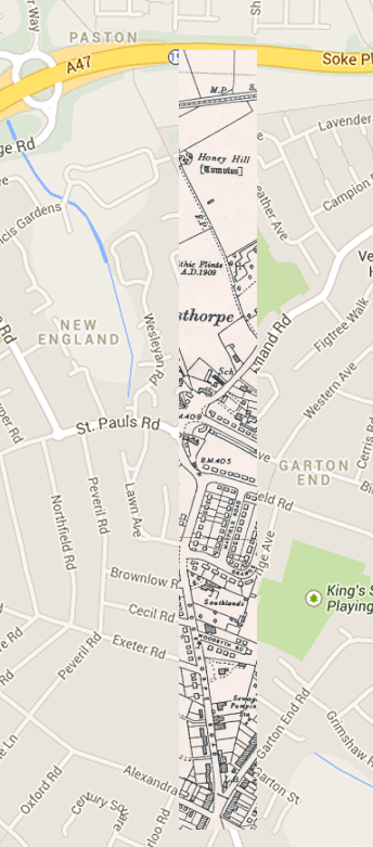 I superimposed the 1950 map onto a modern map to roughly work out where Honey Hill would be today. It seems to be where the footpath from the bottom of Welland Close crosses Bluebell Avenue.